Have also a look on numerical laboratory
Geophysical study of volcanic structures
Contact : Philippe Labazuy
Technical Manager: Thierry Souriot
The internal structure of volcanoes can be studied using geophysical methods.
The LMV has a number of facilities for this purpose.
See the description and access details.
Main techniques used:
-
Spontaneous polarisation (PS)
Measurements of the spontaneous electrical polarisation at the surface of volcanoes allow, in particular, to highlight hydrothermal circulations.The LMV has very high impedance voltmeters, impolarisable electrodes and cables necessary for PS measurement campaigns.

PS anomaly of 2000 mV on a zone of high hydrothermal activity at Piton de la Fournaise. -
dGNSS
The LMV has differential GNSS equipment from TopCon (off-line only) and Trimble (very recent and full RTK) brands. The accuracy of these devices can reach the millimeter. They are used for various types of measurements ranging from micro-topography to the positioning of other geophysical devices for field measurements or rock sampling. In this case, the accuracy allows for 2D and 3D tomography and inversions.

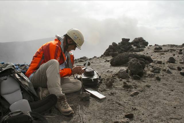
Récepteur mobile utilisé pour localiser des mesures de gravimétrie sur le volcan Yasur (Vanuatu). -
Georadar
The LMV has two Ground Penetrating Radar (GPR) devices.
- Georadar SIR3000 with 400, 200 and 100MHz shielded antennas.
- Georadar MALA ProEx with 30MHz antennas.
-

Drones
After using external service providers for a few years, we have our own fleet and are developing our own sensors through the OPGC service. As the use of drones is highly regulated, we cannot lend them out, but collaboration are possible.
Our current fleet:
- Escadrone Raven HL2 X8 (2016) equipped with a Sony QX1 and various « in-house » sensors.
- DJI Phantom 2 (2015) Upgraded Hero4 Edition (Zenmuse H4-3D).
- Pixy (2001) with DSLR pod.


