 |
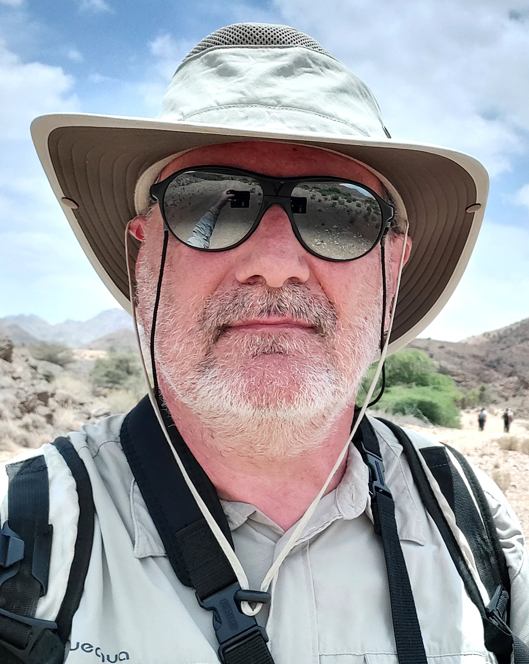
Thierry Souriot
Développement géophysique et informatique Responsable technique du laboratoire Traitement numérique et du laboratoire Géophysique
|
-
Activité
- Mesures géophysique des déformations en terrain volcanique : dGNSS, photogrammétrie, scan, ERT.
- Télépilote drone d’acquisition de données en volcanologie.
- Traitement d’images diverses : images satellitale, aériennes, sol,microscopiques, etc….
- Développement et gestion de base de données.
- Développement et optimisation des chaînes de calculs automatisées.
- Création, programmation et gestion de site Web.
- Gestion informatique et technique de laboratoire.
- Assistance technique à divers personnel.
- depuis 2017 : Mise en ligne de la collection de minéralogie, chaîne de traitement photo, rendu 3D, base de données, programmation du site web.
- depuis 2013 : Création, développement et gestion du laboratoire de Géophysique.
- depuis 1999 : Création, développement et gestion du laboratoire de Traitement numérique.
Membre des réseaux métiers CNRS

Drone & Cap

RENAG

RTCE
MAPI
SISTResponsabilités administratives
- Au L.M.V.
- 2013-2019 : Correspondant formation du CNRS (COFO).
- Création et gestion de sites webs : L.M.V. (1999-2015), O.I.² (1999-2013), TOMUVOL (2010-2015), DEGAZMAG (2013-2016), etc…
- 2012-2017 : Membre élue du conseil d’administration.
- depuis 1999 : Membre de la commission informatique.
- A l’O.P.G.C. :
-
- 2006-2010 et 2018-2022 : Membre élue du conseil d’administration.
- 2010-2014 : Membre élue du conseil scientifique.
- depuis 2011 : Membre de la commission informatique.
-
-
Compétences
- Géodésie :
- Station total (Trimble SX10).
- Positionnement différentielle (dGNSS,RTK,NTrip) système Trimble, TOPCON, Centipède.
- Positionnement classique (Théodolite, niveau, distancemètre).
- Logiciel TBC, TopconTools, QGIS.
- Traitement d’image :
- Photogrammétrie sol, aérienne et spatiale.
- Télépilote Drones.
- Génération de modèle numérique. (ENVI, LPS, Metashape, CloudCompare, TBC).
- Traitement d’image divers (FIJI, Hugin, OTB, Gimp …).
- Interférométrie radar (Diapason, NEST …).
- Informatique :
- Programmation (C, PHP, Bash, Javascript, MPI, OpenMP).
- Base de données (MySQL, CSV, XML).
- Serveur web (HTML, CSS, Joomla!, SPIP, WordPress).
- Administration système (Linux, Windows).
- Logiciels divers (Photoshop, Illustrator, Gimp, Inskape, ImageMagik …).
- Thématique scientifique :
- Déformation des édifices volcaniques
- Tectonique extensive, rifting et point triple.
- Tectonique régionnale.
Formations continues récentes
-
- Stage et obtention du CATS (Télépilote Drone européen A1-A3 & STS)
- Colloques « Drones et Capteurs »
- Utilisation de la station totale Trimble SX10
- Stage et obtention du CATT (Télépilote Drone français)
- Utilisation de dGNSS Trimble R10
- Atelier « Centipède »
- Utilisation de FULLWAVER tomographie électrique 3D
Total de 1998 à 2021, 55 formations sur 125 jours
- Géodésie :
-
Programmes de recherche récents
-
- ANR : MACIV, Tomographie sismique 3D du massif central.
- ANR : Scan4Volc, Étude géophysique 4D du Piton de la Fournaise.
- PROVA et PROVA2 : Surveillance géodésique du massif central.
- CAPRICE : Étude des circulation d’eau dans la Chaîne des Puys.
- GeolVir3D : Visite virtuelle géologique à but pédagogique.
Missions de terrain significatives
- Nombreuses missions en France depuis 2013, principalement en soutient géodésique sur des profile ERT et électrique 3D.
- 2025 Missions géophysiques dans le massif central (sismologique et positionnement).
- 2025 Mission prospective en république de Djibouti.
- 2023 Mission géophysique sur l’Île de la Réunion (tomographie ERT 3D).
- 2019 Mission en Islande (positionnement ERT).
- 2012 Missions Interférométrie radar sur l’Île de la Réunion.
- 2008 Mission géodésique sur les lahars du Merapi.
- 2001 Missions géophysiques divers sur l’Île de la Réunion.
- 1998 Mission géophysique marine (seabeam) sur l’Atalante ride médio-Atlantique (Açores).
- 1995 Mission géophysique marine (seabeam) sur l’Atalante dans le golf d’Aden.
- Entre 1989 et 1997, 4 mission tectonique en république de Djibouti et en Éthiopie.
Total de 1998 à 2021, 98 missions sur 463 jours.
-
-
Articles scientifiques référencées au LMV depuis 2010 :
11 publication(s) | Article scientifique au 14/07/2026-
Gailler L.
,
Guillard R.
,
Buvat S.
,
Labazuy P.
, Finizola A., Roulleau E.,
Lénat J.F.
,
Aumar C.
,
Boudoire G.
, Camus B.,
Cluzel N.
, Delcher E.,
Dumont Q.
, Gusset R., Métral L., Peltier A., Perrier L., Poussin L., Régis E.,
Souriot T.
,
Thebault E.
, Tobías López D., Villeneuve N.
(2025)
. A unique electrical resistivity experiment reveals the 3d interior of piton de la fournaise. SCREPORT
(Scientific Reports)
. vol.1, p.35794,
DOI

-
Rafflin V.
,
Gailler L.
,
Aumar C.
,
Cluzel N.
, Gal F., Giuffrida G., Grassa F.,
Harris A.
,
Kelfoun K.
,
Souriot T.
,
Boudoire G.
(2025)
. Preferential fluids ascent paths revealed by coupling chemical, electrical and magnetic methods: insights for risk mitigation in a long‐dormant volcanic province (monts dore, france). JGR
(Journal of Geophysical Research - Solid Earth)
. vol.130,
DOI
- Shapiro N., Aubert C., Chevrot S., Mordret A., Paul A., Sylvander M.,
Laumonier M.
,
Boudoire G.
,
Laporte D.
,
Cluzel N.
,
Battaglia J.
, Scheiblin G., Pauchet H.,
Souriot T.
, Brenguier F., Campillo M., Plazolles B.,
Gailler L.
,
Thebault E.
(2025)
. Deep long period earthquakes beneath volcanoes of the french massif central. GRL
(Geophysical Research Letters)
. vol.52, p.E2025gl114904,
DOI
- Aubert C., Scheiblin G., Paul A., Pauchet H., Mordret A., Baudot V., Chevrot S.,
Cluzel N.
, Chevrot I., Grimaud F., Jung A., Mercier S., Pawlowski P., Roussel S.,
Souriot T.
, Shapiro N., Sylvander M., Vial B., Wolyniec D.
(2025)
. The maciv multiscale seismic experiments in the french massif central (2023 2027): deployment, data quality and availability. ANNALS GEOPH
(Annals of Geophysics)
. vol.68,
DOI
-
Gailler L.
, Grace C.,
Boudoire G.
, Grunberg M.,
Battaglia J.
,
Merciecca C.
,
Labazuy P.
,
Souriot T.
, Douchain J.M.,
Cluzel N.
, Guillard R.,
Freret-Lorgeril V.
,
Aumar C.
,
Rafflin V.
, Boulenger V.,
Buvat S.
, Kuzamba J.,
Thebault E.
(2025)
. Scientific response to the 2021–2022 seismic swarm in the monts dore volcanic province (france): structural insights from punctual surveys (1/2). CRAS
(Comptes Rendus de l'Académie des Sciences)
. vol.357, p.61-78,
DOI
-
Boudoire G.
,
Gailler L.
,
Battaglia J.
, Beauger A., Bontemps M.,
Bosse V.
, Breton V.,
Briot D.
, Cacault P.,
Cayol V.
,
Cluzel N.
, Delage E., del Campo G.,
Deniel C.
,
Devidal J.L.
, Douchain J.M., Faissal A., Freville P., Frondini F.,
Gauthier P.J.
, Genzano N., Grace C., Grassa F., Grunberg M., Guéhenneux Y.,
Gurioli L.
,
Harris A.
,
Labazuy P.
,
Laporte D.
, Longo M., Marchese F., Mazet-Roux G.,
Médard E.
,
Merciecca C.
, Métois M., Pergola N., Pouget M.,
Rafflin V.
, Regis E., Ricci L., Rizzo A.L.,
Souriot T.
,
Terray L.
, Tramutoli V., Trull-Hernandis V.,
Van Wyk De Vries B.
, Voldoire O.,
Thebault E.
(2025)
. Scientific response to the 2021–2022 seismic swarm in the monts dore volcanic province (france): dynamic insights from temporal surveys (2/2). CRAS
(Comptes Rendus de l'Académie des Sciences)
. vol.357, p.79-103,
DOI
-
Gailler L.
,
Labazuy P.
, Régis E., Bontemps M.,
Souriot T.
,
Bacques G.
, Carton B.
(2021)
. Validation of a new uav magnetic prospecting tool for volcano monitoring and geohazard assessment. REMOTESENS
(Remote Sensing)
. vol.13, p.894,
DOI
-
Froger J.L.
,
Souriot T.
, Villeneuve N., Rabaute T., Durand P.,
Cayol V.
, Di Muro A., Staudacher T., Fruneau B.
(2014)
. Apport des données terrasar x pour le suivi de l'activité du piton de la fournaire. REVPHOT
(Revue Française de Photogrammétrie et de Télédétection)
. p.86-101,
DOI
- Froger J.L. , Souriot T. , Villeneuve N., Rabaute T., Durand P., Cayol V. , Di Muro A., Staudacher T., Fruneau B. (2012) . Apport des données terrasar x pour le suivi de l’activité du piton de la fournaise. revue française de photogrammétrie et de télédétection 197, 86 101..
- Béné S., TOMUVOL Collaboration (2012) . Air shower simulation for background estimation in muon tomography of volcanoes. geoscientific instrumentation, methods and data systems 2, 563 574,. DOI
- Vargas Franco R., Thouret J.C. , Delaite G., van Westen C., Sheridan M.F., Siebe C., Mariño J., Souriot T. , Stinton A. (2010) . Mapping and assessing volcanic and fl ood hazards and risks, with emphasis on lahars, in arequipa, peru. in g groppelli & l. viereck goette, eds.,’stratigraphy and geology of volcanic areas’, geologic. DOI
Articles scientifiques avant 2010 :
- Thouret J.C., Wörner G., Gunnell Y., Singer B., Zhang X., Souriot T. (2007), “Geochronologic and stratigraphic constraints on canyon incision and Miocene uplift of the Central Andes in Peru.”, Earth and Planetary Science Letters 263, 151-166. doi:10.1016/j.epsl.2007.07.023.
- Delaite G., Thouret J.C., Sheridan M., Labazuy P., Stinton A., Souriot T. and Van Westen C., (2005), “Assessment of volcanic hazards of El Misti and in the city of Arequipa, Peru, based on GIS and simulations, with emphasis on lahar.”, Z.Geomorph.N.F., Sup.Vol.140, p209-231. doi:0044-2798/050140-0209.
- Froger J., Fukushima Y., Briole P., Staudacher T.,Souriot T., and Villeneuve N. (2004), “The deformation field of the August 2003 eruption at Piton de la Fournaise, Reunion Island, mapped by ASAR interferometry.”, Geophys. Res. Lett., 31, L14601L14601,doi:10.1029/2004GL020479.
- Dauteuil O., Huchon P., Quemeneur F. Souriot T., (2001), “Propagation of an oblique spreading centre: the western Gulf of Aden.”, Tectonophysics, Vol. 332, p. 423-442. , doi:10.1016/S0040-1951(00)00295-X.
- Goslin J. and the TRIATNORD scientific party: Benoit M.,Blanchard D., Bohn M., Dosso L., Dreher S., Etoubeau J., Gente P., Gloagen R., Imazu Y., Luis J., Maia M., Merkouriev S., Oldra J.-P., Patriat P., Ravilly M., Souriot T., Thirot J.-L., and Yama-Ashi T.. (1998), “Hotspot influence on slow-ridge accretion processes: preliminary results of the TRIATNORD cruise on the MAR north of the Azores (R/V L’Atalante, 6/25-7/21/1998).”, InterRidge News, vol. 7(2), p. 25-30.
- Bonini M., Souriot T., Boccaletti M., et Brun JP., (1997), “Successive orthogonal and oblique extension episodes in a rift zone: Laboratory experiments with application to the Ethiopian Rift.”, Tectonics, Vol. 16-2, p. 347-362. , doi:10.1029/96TC03935
- Rouby D., Souriot T., Brun J.P., et Cobbold, PR., (1996),”Displacements, strains and rotations within the Afar depression (Djibouti) from restoration in map view.”, Tectonics, Vol. 15-5, p.952-965. , doi:10.1029/96TC00849
- Souriot T., (1993), “Cinématique de l’extension post-pliocène en Afar. Imagerie satellitaire et modélisation analogique.”, Mémoire de Géosciences-Rennes, (Rennes, Fr.:Géosciences-Rennes), Vol. 50, 225 p.
- Souriot T., et Brun J.P., (1992), “Faulting and block rotation in the Afar triangle: the Danakil “crank arm” model.”, Geology, Vol. 20,10, p. 911-914. , doi:10.1130/0091-7613
- Souriot T., Balllard J.F., et Brun J.P., (1991), “Influence des barrières sur la propagation de la déformation le long des surfaces de décollement : étude expérimentale.”, C.R.Acad.Sci.Paris, Vol.312,Série II, No , p. 69-75.
Congrès référencées au LMV depuis 2010 :
38 publication(s) | congrès au 14/07/2026- Aumar C. , Buvat S. , Labazuy P. , Merle O. , Gailler L. , Donnadieu F. , Souriot T. , Merciecca C. (2021) . 3d geological modelling in a volcanic environment with a combined geophysics geomorphology approach: the case study of the cheire de côme (puy de dôme, france).
- Carloganu C., the TOMUVOL collaboration (2018) . Density imaging of puy de dôme volcano with atmospheric muons in french massif central as a case study for volcano muography. oral, egu general assembly 2018, geophysical research abstracts vol. 20.
- Barnoud A., TOMUVOL (2017) . High resolution muography of volcanoes : density imaging of puy de dôme as proof of principle.
- Barnoud A., TOMUVOL (2016) . Towards density imaging of volcanoes by joint inversion of muographic and gravimetric data.
- Barnoud A., TOMUVOL (2016) . High resolution muography of volcanoes : density imaging of puy de dôme as proof of principle.
- Carloganu C., Le Ménédeu E., TOMUVOL, Labazuy P. (2016) . Density imaging of puy de dôme volcano with atmospheric muons in french massif central as a case study for volcano muography.
- Gailler L. , Labazuy P. , TOMUVOL Collaboration (2014) . The tomuvol project: technical evolution and scientific contributions to volcanoes high resolution imaging. cities on volcano, september 9 13, yogyakarta, indonesia..
- Miallier D., Boivin P. , Labazuy P. , TOMUVOL Collaboration (2013) . Geology of a volcanic edifice selected as a reference experimental site for muon imagery and geophysics: puy de dôme volcano (chaîne des puys, france). in iavcei. session 2 2c: imaging volcanoes and g.
- Cârloganu C., TOMUVOL Collaboration (2013) . Volcano radiography with grpcs. in muon and neutrino radiography 2013 meeting, tokyo (japan), july 25 26..
- Bato M.G. , Froger J.L. , Harris A. , Villeneuve N., Souriot T. (2013) . Characterizing the october 2010 lava flow of piton de la fournaise using space based data. in international association of volcanology and chemistry of the earth's interior scientific assembly, kagosh.
- Bato M.G. , Froger J.L. , Harris A. , Villeneuve N., Souriot T. (2013) . Tandem x data for early mapping and volume estimation of lava flows: october 2010 lava flow of piton de la fournaise case study. in 5th terrasar x and 4th tandem x scientific meeting, munich, germany,.
- Bato M.G. , Froger J.L. , Harris A. , Villeneuve N., Souriot T. (2013) . Characterizing the october 2010 lava flow of piton de la fournaise using x band insar data. in ieee international geoscience and remote sensing symposium, melbourne, australia, july 21 26, 2013. (for.
- Portal A. , Labazuy P. , Lénat J.F. , TOMUVOL Collaboration (2013) . Geophysical study of a volcanic edifice for comparison with muon imaging. in iavcei 2013 scientific assembly july 20 24, kagoshima, japan, p 399..
- Lénat J.F. , Portal A. , Labazuy P. , TOMUVOL Collaboration (2013) . Geophysical study of a volcanic edifice for comparison with muon imagery. in iavcei. session 2 2c: imaging volcanoes and geothermal systems with muon radiography. july 20 24, 2013. kagoshima. japan..
- Portal A. , TOMUVOL Collaboration (2012) . Inner structure of the puy de dôme volcano: cross comparison of geophysical models (ert, gravimetry, muonic imagery). muon and neutrino radiography 2012 workshop, april 18 20 2012, clermont ferrand, f.
- Labazuy P. , TOMUVOL Collaboration (2012) . Development and validation of muon imaging techniques to investigate the internal structure of volcanoes by integrating geophysical and muon tomography methods. egu general assembly. vienna. austria..
- Froger J.L. , Cayol V. , Augier A., Bato M.G. , Villeneuve N., Souriot T. , Menassian S., Eschbach B., Durand P., Staudacher T., Di Muro A., Fruneau B., Rabaute T., Tinel C. (2012) . Nine years of insar monitoring of piton de la fournaise: results and perspectives. agu chapman conference, hawaiian volcanoes from source to surface, waikoloa, hawaii, usa, 20 24 august 2012..
- Froger J.L. , Bato M.G. , Souriot T. , Villeneuve N., Durand P., Cayol V. , Di Muro A., Staudacher T., Fruneau B. (2012) . High resolution interferometric monitoring of piton de la fournaise with cosmo skymed data. esa meeting, agence spaciale italienne, rome, march 2012..
- Fehr F., TOMUVOL Collaboration (2012) . Presentation of the muon radiography of puy de dôme. muon and neutrino radiography, april 18 20, clermont ferrand, france..
- Cayol V. , Froger J.L. , Augier A., Fukushima Y., Bato M.G. , Villeneuve N., Souriot T. (2012) . Use of insar at piton de la fournaise. undervolc meeting, paris, march 2012..
- Portal A. , TOMUVOL Collaboration (2012) . Tomographie muonique du puy de dôme (france) : comparaison avec des méthodes géophysiques (ert et gravimétrie)..
- Labazuy P. , TOMUVOL Collaboration (2012) . Application de la radiographie muonique à la surveillance de l’activité des édifices volcaniques. colloque 2012 du comité national français de géodésie et géophysique : mesure et modélisation en volca.
- Labazuy P. , TOMUVOL Collaboration (2012) . Development and validation of imaging techniques to investigate the internal structure of volcanoes: the case study of puy de dôme..
- Labazuy P. , TOMUVOL Collaboration (2012) . Application de la radiographie muonique à la surveillance de l’activité des édifices volcaniques. 3ème colloque du cnfgg, mesure et modélisation en volcanologie, 10 13 octobre 2012, clermont ferrand,.
- Labazuy P. , TOMUVOL Collaboration (2012) . Requirements for a survey system of active volcanoes based on muon radiography. muon and neutrino radiography, april 18 20, clermont ferrand, france..
- Cayol V. , Augier A., Froger J.L. , Souriot T. (2012) . Improving the determination of volumetric sources from insar data. colloque du cnfgg, mesure et modélisation en volcanologie, clermont ferrand, oct. 2012..
- Cârloganu C., Niess V., TOMUVOL Collaboration (2012) . Towards a muon radiography of the puy de dôme. muon and neutrino radiography, april 18 20, clermont ferrand, france..
- Labazuy P. , TOMUVOL Collaboration (2012) . Development and validation of muon imaging techniques to investigate the internal structure of volcanoes by integrating geophysical and muon tomography methods. geophysical research abstracts, vol. 14.
- Béné S., TOMUVOL Collaboration (2012) . Atmospheric showers simulation for background estimation in muon tomography of volcanoes. proceeding nat. hazards earth syst. sci..
- Froger J.L. , Villeneuve N., Souriot T. , Rabaute T., Durand P., Cayol V. , Di Muro A., Staudacher T., Fruneau B., Tinel C. (2011) . High resolution interferometric monitoring of piton de la fournaise with terrasar x data. 4: terrasar x science team meeting 14 16 february 2011 at dlr oberpfaffenhofen, germany..
- Froger J.L. , Bato M.G. , Villeneuve T., Souriot T. , Rabaute T., Durand P., Cayol V. , Di Muro A., Staudacher T., Fruneau B., Tinel C. (2011) . High resolution interferometric monitoring of piton de la fournaise with terrasar x and cosmo skymed data: fringe, rome, 19 sep. 23..
- Fehr F., TOMUVOL Collaboration (2011) . Towards tomographic imaging of the puy de dôme with grpcs: egu general assembly 2011, geophysical research abstracts, vol. 13, egu2011..
- Lénat J.F. , TOMUVOL Collaboration (2011) . Anatomy of a lava dome using muon radiography and electrical resistivity tomography: agu fall metting, san francisco, 3 9 dec. 2011, v41h 03..
- Cayol V. , Augier A., Froger J.L. , Souriot T. (2011) . Improving the determination of volumetric sources from insar data: fringe2011 workshop “advances in the science an applications of sar interferometry from esa and 3rd party missions”, frascati, italie.
- Cârloganu C., TOMUVOL Collaboration (2011) . Density imaging of volcanoes with atmospheric muons using a glass resistive plate chambers detector: international workshop on high energy geophysics 2011, muon and neutrino radiography, october 27 28.
- Cârloganu C., TOMUVOL Collaboration (2011) . Density imaging of volcanos with atmospheric muons: the 2011 europhysics conference on high energy physics hep 2011. july 21 27, 2011 grenoble, rhône alpes france. proceedings of sciences. 5 p..
- Guéhenneux Y., Labazuy P. , Bergès J.C., Cacault P., Souriot T. (2010) . Observation, surveillance et alerte temps réel de l’activité des volcans par télédétection des points chauds et des panaches de cendres. colloque “les satellites grand champ pour le suivi de l'environ.
- Froger J.L. , Souriot T. , Augier A., Cayol V. , Byrdina S. (2010) . Volinsar pf, service d’observation insar multicapteurs sur le piton de la fournaise. colloque « les satellites grand champ pour le suivi de l’environnement, des ressources naturelles et des risques »,.
Autres publication référencées au LMV depuis 2010 :
1 publication(s) | Autre au 14/07/2026- Labazuy P. , Donnadieu F. , Souriot T. , Françoise O., Le Corre G. (2017) . Etude géophysique du maar de chantuzier (haute loire) et de l’environnement du captage de chantuzier.
-
Gailler L.
,
Guillard R.
,
Buvat S.
,
Labazuy P.
, Finizola A., Roulleau E.,
Lénat J.F.
,
Aumar C.
,
Boudoire G.
, Camus B.,
Cluzel N.
, Delcher E.,
Dumont Q.
, Gusset R., Métral L., Peltier A., Perrier L., Poussin L., Régis E.,
Souriot T.
,
Thebault E.
, Tobías López D., Villeneuve N.
(2025)
. A unique electrical resistivity experiment reveals the 3d interior of piton de la fournaise. SCREPORT
(Scientific Reports)
. vol.1, p.35794,
DOI